🎵 Audio guide
Salorino, located in the far south-east of the province of Cáceres, is part of the Tagus International Biosphere Reserve. The surrounding environment is composed of gently rolling hills which form the River Salor plain. To the north, the precipitous Salor gorges and their streams form part of the Tagus International Natural Park and to the south, the Sierra de San Pedro, with the peak of El Torrico, is a Special Protection Area which forms the divide between the Guadiana and Tagus River basins.
These lands have been inhabited since ancient times. Over the centuries, the various civilisations which have passed through have left their mark, their traditions and cultures. It wasn’t until the 13th century, after the Reconquista, that the seeds of the village of Salorino were sown, originally a way station and resting place beside the spring, El Lugar.
Salorino’s proximity to the Alcántara drovers’ road (Cordel de Alcántara) and the regular transhumance encouraged the appearance of lodges and inns, such as La Porra, which contributed to the establishment of the village. The drovers’ road connects Cáceres with the Cañada Real de Gataand meets the Colada del CaminodeAlbuquerque, which crossesthe mountain pass over the Sierra de San Pedro, forming part of this network of drovers’ roads.
Under the Order of Alcántara, in the 15th century, the boundaries of the village of Salorino and its surroundings were established. Its lands were divided into four encomiendas(land and labour awarded by the state to nobles). After the disendowment in the 19th century, the majority of large estates came into private ownership.
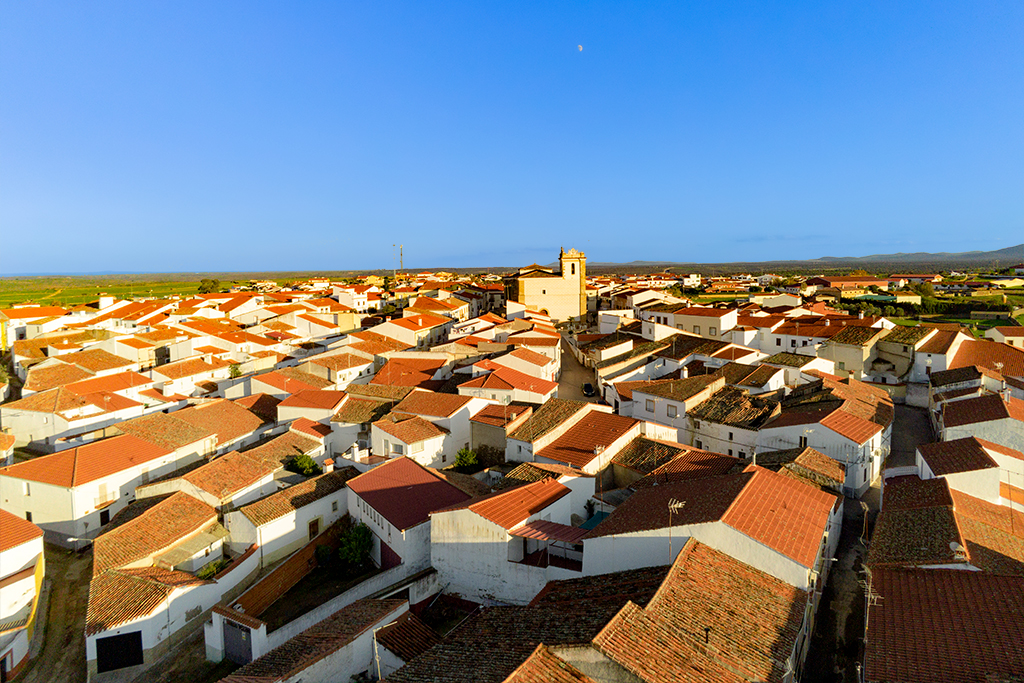
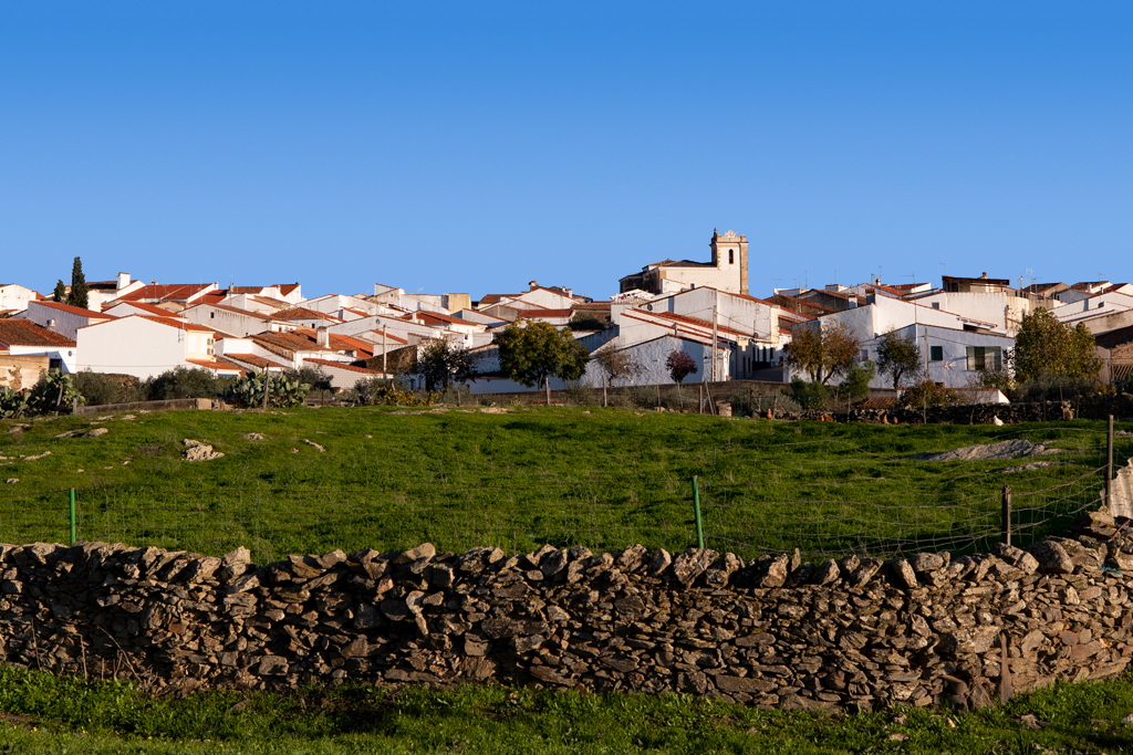
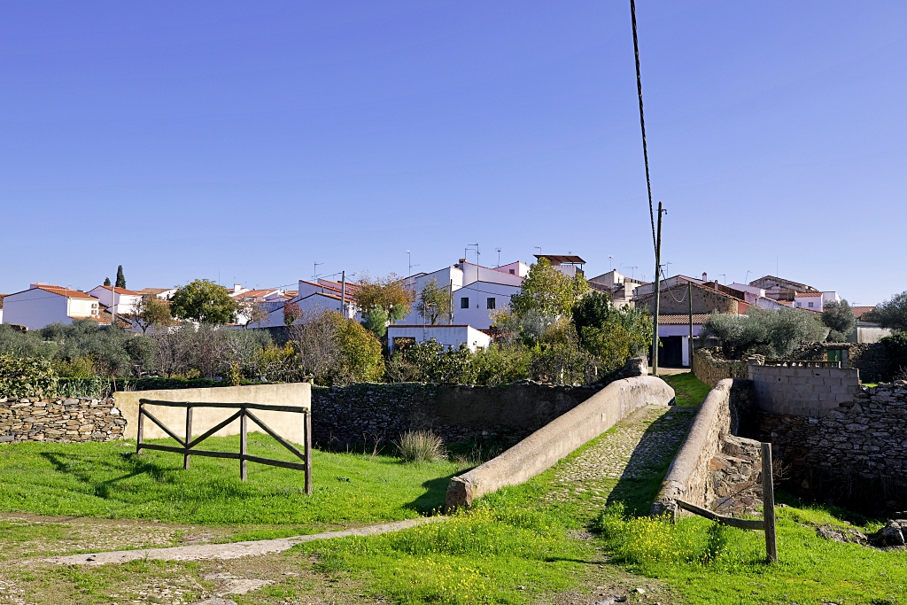
The oldest part of Salorino, around the church and on the banks of the Arroyo del Lugar consists of narrow, irregular blocks of traditional houses which had their main entrance on one street and an entrance to the attached stable and animal pen in another street. They are low buildings with ribbed vaults in their interior.
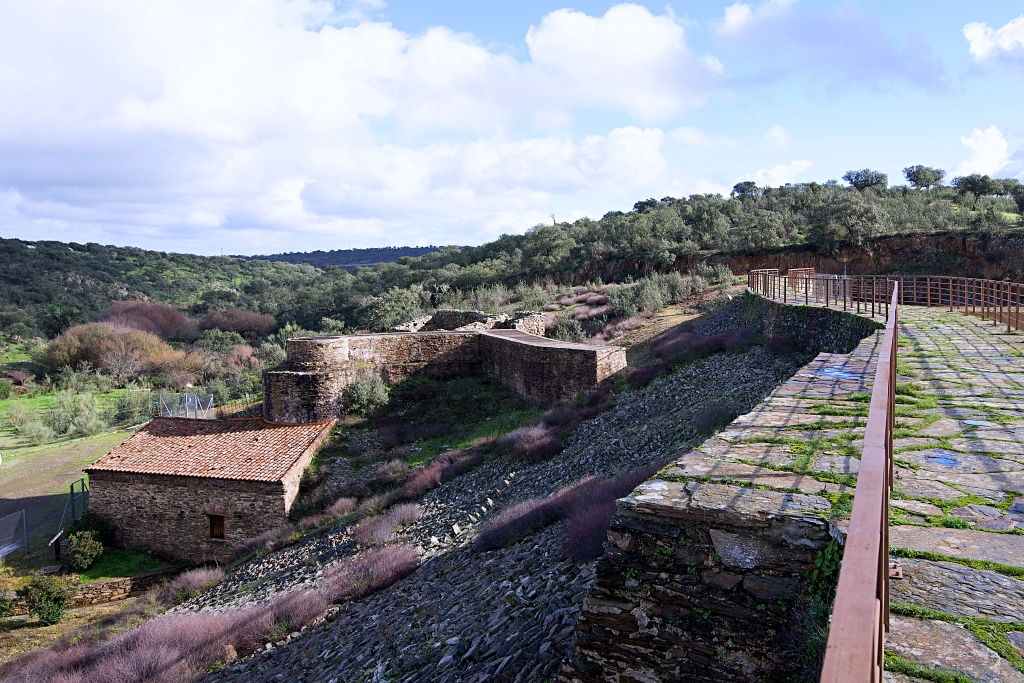
The people of Salorino took steps to tame their territory, taking advantage of all possible resources. Reapers, shearers, mule drivers, farm workers, shepherds, millers, tanners, cork harvesters and beekeepers amongst others, have all left their mark on Salorino. Old mills, with their water-powered machinery, apiaries and stone huts remain as witnesses to the history of these people.
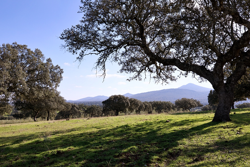
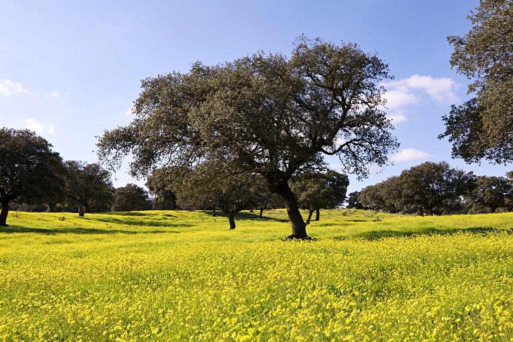
Salorino’s surroundings are diverse. The Sierra de San Pedro, a Special Protection Area of Mediterranean forest, with its peak El Torrico, forms the southern limit. On the lower slopes there is dehesa, wooded pasture, which becomes less and less densely forested, as its proximity to the Sierra decreases.
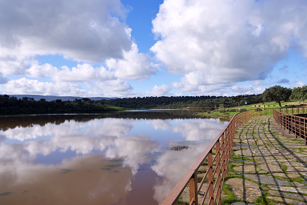
The land closest to the village is predominantly used for grazing and cereal crops, criss-crossed with a network of tracks between walls and fences. To the north, towards the Riberos del Salor (Salor gorges), there are higher hills and steep gorges containing the streams losMolinos, el Getrero and las Torres, which are part of the Tagus International Natural Park.
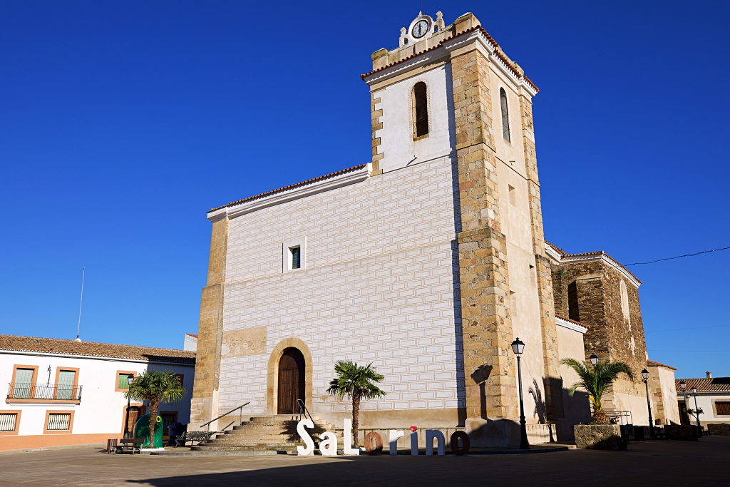
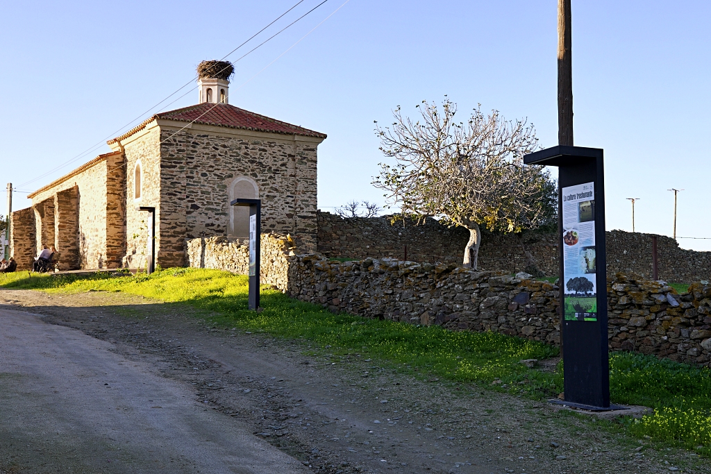
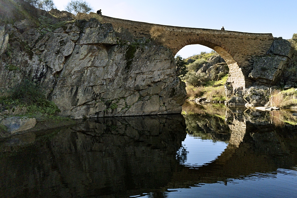
Salorino has a variety of interesting features, including the 16th - 18th century Church of St Ildefonsus and the Chapel of Saint Anne, the House of the Roma People interpretive centre, the Torrico de San Pedro and Puente del Infierno walking trails, the reservoir, the old mills and its traditional architecture.
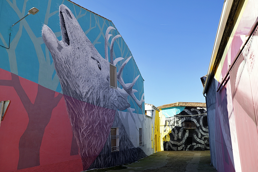
Special mention must be made of the walking trail through the village to view the Tagus International Biosphere Reserve murals, including the Tagus International Living Memorial museum. For nature-lovers, Salorino offers outdoor activities, such as hiking, bird-watching and fishing.